Though Earth is densely crowded with humans now, yet there are places which are really remote and humans place their feet not even in decades. One such place is the remotest island in the world. It is the Bouvet island, named after it’s discoverer. The island is so remote and difficult to approach that it took around a century for any human being to land in it after its first viewing.
The story of Bouvet island’s discovery is interesting. The island was first discovered by Jean-Baptiste-Charles Bouvet, a French Navigator in 1739. He was born into a distinguished naval family but orphaned at an early age. As a grown up boy he joined the French India company in 1731 and eventually attained the lieutenant rank soon. For three years he tried to persuad the company to send him south on an exploration to look for harbors suitable for company’s use. He was actually hoping to locate the land reported by Binot Paulmyer De Gonneville when he returned to France after a expedition in 1505. Gonneville stated that he had spent six months in a land far south, whose fine climate and friendly inhabitants commended it to french colonization. This virtual land was called “Gonneville Land” at that time. Gonneville probably referred to a land near Brazil, but Bouvet’s expectation was to find that land sailing far south from the Cape of Good Hope.
Finally his appeal was accepted by his company and he started his expedition equipped with two ships, the 280 tonAgile and 200 ton Marie. He was supplied with provisions sufficient for a voyage of one and a half year. Captain Ducloscommanded Marie and Bouvet commanded Agile as a leader. The two ships started their voyage on 19th July, 1738 from Breton port Lorient. Expecting to find a tropical or at least temperate land, they were ill-prepared for the increasing cold. Bouvet had chosen to explore the are of the world’s oceans most empty of land. With great determination he carried out a thorough search between latitudes 44 and 55 degree South. On 1st January, 1739 a land was first seen, a high rock cliff, possibly an island, or more likely according to Bouvet, a promitory of a larger land. Despite of bad climate and scurvy rife among his crew, Bouvet kept this island in view for tweleve days. While he desperately attempted to approach closer to the island, always being kep away by the impassible ice. They also didn’t dare to launch boats for the fear that they will not be able to find Agile and Marie again in the fog.Eventually the attempt had to be abandoned, leaving the true nature of his discovery unknown, Bouvet sailed back north to reach Cape of Good Hope on 24th February and lorient on June 24th.
Unfortunately, Bouvet, a very competent navigator but handicapped by the instruments available to hime at that time, gave the position of the island as 54 degree South and 11 degree East. He named the land he saw as Cape Circumcision. Many later expeditions were made to search for Cape Circumcision. But explorer like James Cook, James Clark Ross, Thomas Moore, etc. in mid 19th century failed to find the island. This was because, there location given by Bouvet was significantly erroneous. Meanwhile the island was rediscovered in 1808 by two British whalers in their vessels Snow Swan and Otter , James Lindsay and Thomas Hopper. Because of the wrong coordinates reported by Bouvet, they considered this as a new island and was named as “Lindsay Island”. On December 7 1822, American sealer Benjamin Morrell reported sending his second mate ashore where he took 172 fur seals. he is the first recorded landing on the island. He also measured the circumference as just 25 miles. In 1825, sealers Sprightly and Lively, under the command of Captain george Norris, sighted two islands. He also landed the islands and named them as “Liverpool” and “Thompson”. After this sighting, for decades navigators could not sight the islands. Only in 1878, Captain Williams of America claimed the sighting of the island again. Captain Joseph Fuller also sighted both islands on 1893. But mysteriously, on 1898 when it was rediscovered by Carl Chun, there were undisputed only one island. The Thompson island was never sighted later. It is most likely that the island subsided under sea.
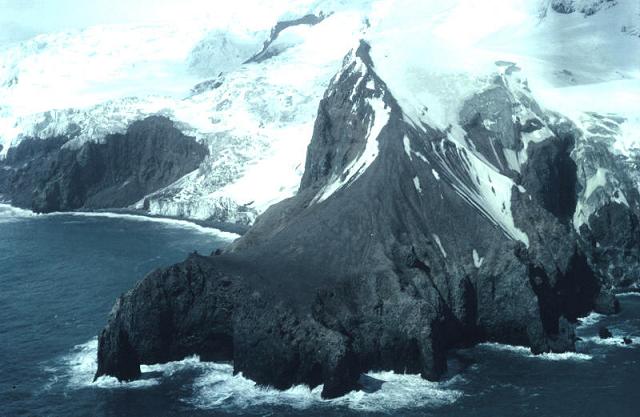
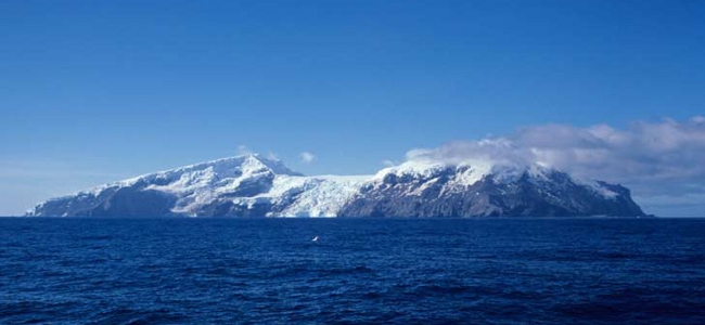
The Bouvet island is a small volcanic island, 6 miles by 4 miles in size. It is the most isolated and remotest island in the world, being 2000 km north of Antarctica and 2525 km south west of South Africa. Bouvet’s success of falling in with this microscopic and isolated spot of land in the course of a brief excursion southward of his normal course is one of the most remarkable lucky dips in the whole history of exploration.
In 1927, Bouvet island was claimed by Norway but British annexed it initially. But later it was accepted and became dependent territory of Norway in 1930. In 1971, Norway declared it as a nature reserve. The island still considered to be difficult to approach by sea. he easiest way to access the island is with a helicopter from a ship.


Recent Comments